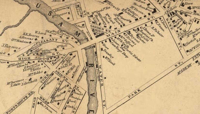
Historic Maps of the Local Area
The two most complete sets of historic maps of the area are from 1856 and 1872, when maps were created for all York County towns. The 1856 set, Map of York County Maine from Actual Survey, was published by J.L. Smith Co., based on the work of the surveyor, J. Chase. The 1872 set were […]


